Quick Navigation
Essential Info
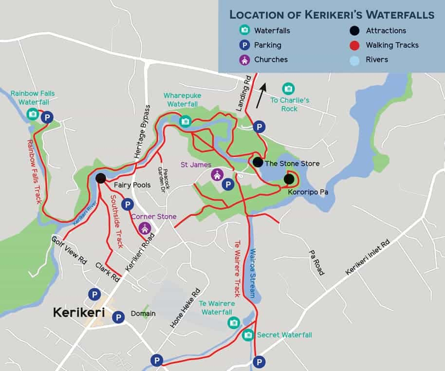
- Location: Kerikeri Basin
- Visit Time: 30-60 minutes
- Entry: Free
- Best Time: Year-round
- Difficulty: Easy walk
About Kororipo Pā
Kororipo Pā is one of New Zealand's most significant historical sites - a fortified Māori village (pā) that was once home to the famous Ngāpuhi chief Hongi Hika. Located on a prominent headland overlooking the Kerikeri Basin, this ancient pā offers visitors a glimpse into pre-European Māori life and the strategic importance of this location.
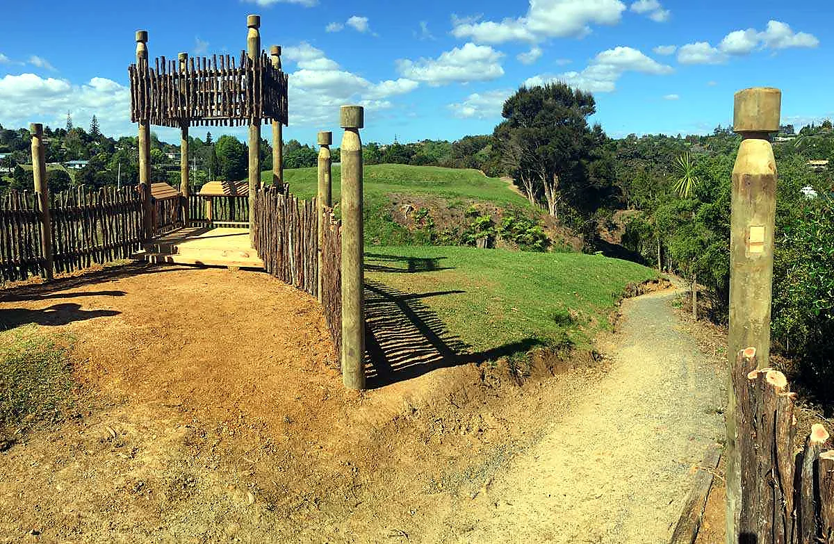
The site features well-preserved defensive terraces, ditches, and earthworks that demonstrate the sophisticated military engineering of Māori fortifications. Today, it's a peaceful place to walk, reflect on history, and enjoy panoramic views of the Kerikeri River and surrounding landscape.
Historical Significance
Chief Hongi Hika
Kororipo Pā was the stronghold of Hongi Hika (c. 1772-1828), one of the most influential Māori chiefs in New Zealand history. A skilled warrior and strategist, Hongi Hika played a pivotal role in early Māori-European relations and the musket wars of the 1820s.
From this pā, Hongi Hika controlled the Kerikeri area and maintained relationships with European missionaries who established the nearby mission station in 1819. The pā's strategic location allowed control of the river and surrounding fertile lands.
The Pā System
Pā were fortified villages that served as defensive strongholds for Māori communities. Kororipo demonstrates classic pā features including:
- Multiple defensive terraces creating obstacles for attackers
- Deep ditches (trenches) for additional protection
- Strategic positioning on elevated ground
- Clear sightlines to spot approaching threats
- Access to water and fertile land for food production
Pā Features to Explore
Defensive Terraces
Walk along the well-preserved terraces that once formed the pā's defensive perimeter. These earthworks, created entirely by hand using wooden tools, demonstrate the engineering skills of Māori builders.
Panoramic Views
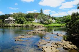
From the highest points of the pā, enjoy stunning views across the Kerikeri Basin, including:
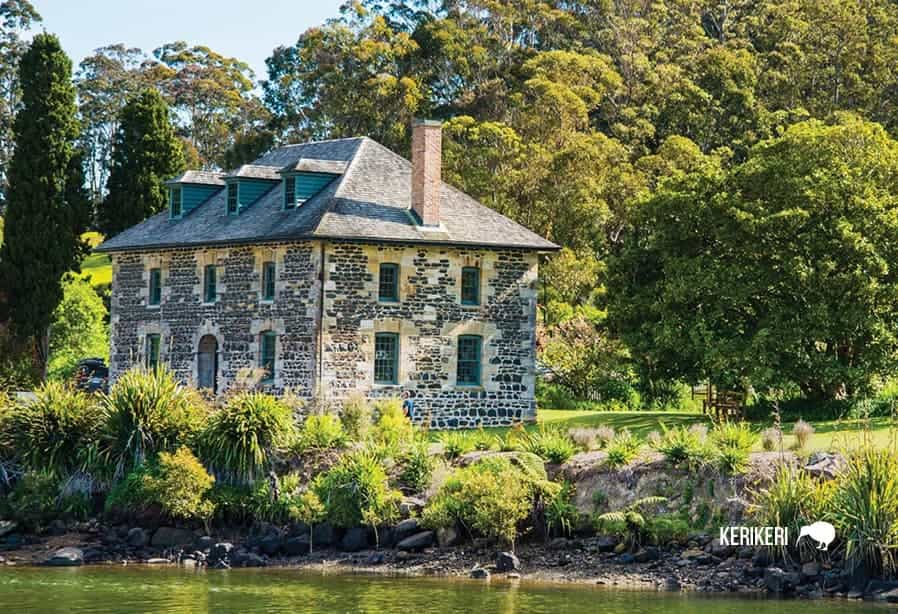
- The historic Stone Store and Kemp House
- Rewa's Village
- The Kerikeri River winding through the valley
- Surrounding farmland and native bush
Photography Tip
The best light for photography is early morning or late afternoon when the sun illuminates the basin below. The elevated position offers excellent opportunities for landscape photography.
Visitor Information
Planning Your Visit
- Location: Access from Landing Road, Kerikeri Basin
- Opening Hours: Open daily, dawn to dusk
- Admission: Free
- Duration: Allow 30-60 minutes
- Facilities: Information panels, walking tracks
- Accessibility: Uneven terrain, moderate fitness required
What to Bring
- Sturdy walking shoes (terrain can be uneven)
- Water bottle
- Sun protection
- Camera for the views
- Insect repellent in warmer months
Respectful Visiting
Kororipo Pā is a sacred site of great cultural significance to Māori. Please treat it with respect:
- Stay on marked paths to protect archaeological features
- Don't remove any stones or artifacts
- Keep noise to a minimum
- Take all rubbish with you

Getting There from Kerigold Chalets
Kororipo Pā is just a 10-minute drive from Kerigold Chalets. Head into Kerikeri township and follow signs to the Kerikeri Basin. Park near the Stone Store and follow the walking track to the pā site.
Where to Stay
Explore Kororipo Pā and Kerikeri's rich Māori heritage by staying at Kerigold Chalets. Our location offers:
- Easy access to all Kerikeri Basin historical sites
- Private, comfortable chalets
- Local knowledge about Kerikeri's history
- Central base for exploring Northland